Beaufort
Beaufort
Stay
See and do
Food and drink
Shopping
Getting around
Visitor information
Located mid-way between Ballarat and Ararat, Beaufort is situated in a rich pastoral district, noted for its merino wool production.
Gold was first discovered around Beaufort in 1852 which saw the town's population rise dramatically, however it was short-lived with most of the alluvial gold gone around 10 years later.
The commercial centre of Beaufort stretches along a section of Neill Street and Lawrence Street, with old-style architecture blended with modern buildings that include a supermarket. A number of historical buildings date back to the gold rush days including the post office, the railway station in Pratt Street and several churches.
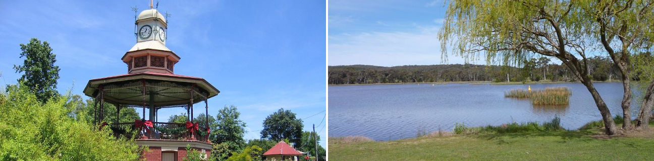
At the western end of Beaufort's commercial centre on Neill Street is an octagonal band rotunda which was built in 1903 and is crowned with an ornate clock. On the other side of the road along Livingstone Street is the attractive triangular-shaped Memorial Park which includes a war memorial and surrounding rose gardens.
Camp Hill Reserve is located off King Street on the north side of Beaufort. Encompassing areas of thick native forest along a ridge overlooking the town centre, it features picnic areas, a BBQ shelter and a lookout area which offers scenic views across the countryside and over Beaufort.
Beaufort Lake is located on the southern edge of town and is adjacent to the Goldfields Recreation Reserve which was first opened as a park in 1884. Access to the lake is either via the main entrance on Skipton Road and past the sports oval, or along Lake Road which follows the bushy eastern shoreline of the lake. There are walking tracks around the lake, the Koori Art Trail with its indigenous artwork, picnic areas, a jetty and a caravan park which overlooks the water.
Lake Goldsmith stretches along the western side of Skipton Road between 10 and 15 kilometres south of Beaufort. A wildlife reserve surrounds part of the lake and includes native grasslands and trees, providing a habitat for duck and bird life.