Camperdown
Camperdown
Stay
See and do
Food and drink
Shopping
Getting around
Visitor information
Camperdown is an agricultural centre located on the world's third largest volcanic plain and surrounded by large salt and fresh water lakes, between Colac and Terang.
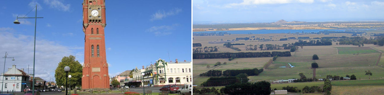
The commercial centre of Camperdown is distinguished by a 2 kilometre long row of elm trees along the main thoroughfare of Manifold Street which is flanked on either side by shops and historic buildings. At the junction of Manifold Street, Pike Street and Church Street is 30 metre tall Gothic-style clock tower which was built in 1896 and is open one Sunday a month for people to climb the stairs to the observation level and enjoy panoramic views over the town. Other significant buildings in the town centre include the post office (1863), court house (1886), IOOF Hall (1896) and several hotels.
For stunning views of the surrounding volcanic peaks, plains and lakes, take a short drive south to the top of Mount Leura. A walking trail extends from the lookout to neighbouring volcanic cone of Mount Sugarloaf.
Follow Park Lane west of Camperdown for about 3 kilometres to the botanic gardens which feature old trees and an array of flowers. A lookout provides views to the twin crater lakes of Lake Bullen Merri and Lake Gnotuk. Swimming and aquatic sports are catered for at the South Beach Reserve at Lake Bullen Merri. Trout and salmon fishing is popular at Lake Purrumbete, a few kilometres south-east of Camperdown.
Along the Princes Highway around Camperdown and neighbouring towns are remnants of stone walls built in the 1800s in at attempt to keep rabbits out of farm land as well as to clear the fields of stones.