Chelsea
Chelsea
Stay
See and do
Food and drink
Shopping
Getting around
Visitor information
Chelsea is a bayside suburb of Melbourne, located between Edithvale and Bonbeach.
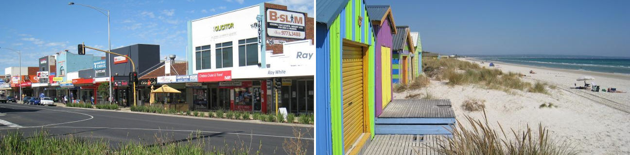
The beach at Chelsea consists of a straight and uninterrupted stretch of coastline, providing scenic views southwards to the Mornington Peninsula. A no boating zone is declared at a 300 metre length of coastline around local surf life saving club, making this area ideal for safe swimming in the sheltered bay waters. A little further south is a short pier which extended into the sea. The foreshore along the beach consists of low sand dunes with groups of colourful bathing boxes situated in native coastal grasses overlooking the water.
The commercial centre of Chelsea is primarily based along the Nepean Highway which runs parallel to the coast. On the eastern side of the highway is a railway line, community buildings and residential areas. The western side of the highway is mainly lined with shops, and behind them is a thin strip of housing which borders the coastal foreshore.
A number of parks and recreational facilities can be found in Chelsea. Victory Park overlooks the beach, located at the end of The Strand and has BBQ facilities and a playground. The Chelsea Bicentennial Park, at the corner of Thames Promenade and Scotch Parade, provides sporting facilities and walking tracks through bushland.
Chelsea Heights is a residential neighbouring suburb of Chelsea, extending eastwards to the Mornington Peninsula Freeway. As well as housing, it is home to part of the extensive Edithvale-Seaford Wetlands system which is well known for its prolific bird life. A walking and cycling track runs along the edge of the wetlands and there are elevated viewing platforms in two of the car parks found along Edithvale Road.
At Chelsea Heights are a number of commercial precincts. There is a small local shopping centre located on Thames Promenade, west of Wells Road. At the junction of Wells Road and Springvale Road is a hotel complex and fast food outlets.