Leongatha - public transport
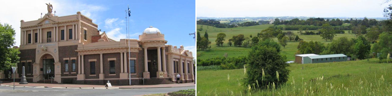
Leongatha
Stay
See and do
Food and drink
Shopping
Getting around
Visitor information
Train
Warragul station
(56 km away)
| Line | Operator | Timetable and stops | Map |
|---|---|---|---|
| Traralgon |  |
Traralgon - Melbourne Via Traralgon, Morwell, Moe, Trafalgar, Yarragon, Warragul, Drouin, Longwarry, Bunyip, Garfield, Tynong, Nar Nar Goon, Pakenham, Berwick, Dandenong, Clayton, Caulfield, Richmond, Flinders Street, Southern Cross |
|
| Bairnsdale | |
Bairnsdale - Melbourne Via Bairnsdale, Stratford, Sale, Rosedale, Traralgon, Morwell, Moe, Warragul, Drouin, Garfield, Pakenham, Dandenong, Caulfield, Richmond, Flinders Street, Southern Cross |
Morwell station
(56 km away)
| Line | Operator | Timetable and stops | Map |
|---|---|---|---|
| Traralgon | |
Traralgon - Melbourne Via Traralgon, Morwell, Moe, Trafalgar, Yarragon, Warragul, Drouin, Longwarry, Bunyip, Garfield, Tynong, Nar Nar Goon, Pakenham, Berwick, Dandenong, Clayton, Caulfield, Richmond, Flinders Street, Southern Cross |
|
| Bairnsdale | |
Bairnsdale - Melbourne Via Bairnsdale, Stratford, Sale, Rosedale, Traralgon, Morwell, Moe, Warragul, Drouin, Garfield, Pakenham, Dandenong, Caulfield, Richmond, Flinders Street, Southern Cross |
Pakenham station
(76 km away)
| Line | Operator | Timetable and stops | Map |
|---|---|---|---|
| Pakenham |  |
Pakenham - Melbourne Via Pakenham, Cardinia Road, Officer, Beaconsfield, Berwick, Narre Warren, Hallam, Dandenong, Yarraman, Noble Park, Sandown Park, Springvale, Westall, Clayton, Huntingdale, Oakleigh, Hughesdale, Murrumbeena, Carnegie, Caulfield, Malvern, Armadale, Toorak, Hawksburn, South Yarra, Richmond, Parliament, Melbourne Central, Flagstaff, Southern Cross, Flinders Street |
|
| Traralgon | |
Traralgon - Melbourne Via Traralgon, Morwell, Moe, Trafalgar, Yarragon, Warragul, Drouin, Longwarry, Bunyip, Garfield, Tynong, Nar Nar Goon, Pakenham, Berwick, Dandenong, Clayton, Caulfield, Richmond, Flinders Street, Southern Cross |
|
| Bairnsdale | |
Bairnsdale - Melbourne Via Bairnsdale, Stratford, Sale, Rosedale, Traralgon, Morwell, Moe, Warragul, Drouin, Garfield, Pakenham, Dandenong, Caulfield, Richmond, Flinders Street, Southern Cross |
Bus
| Route | Operator | Timetable | Map |
|---|---|---|---|
| Wonthaggi to Leongatha Via Cape Paterson, Inverloch |
Westernport Roadlines | ||
| Wonthaggi to Traralgon Via Inverloch, Leongatha, Mirboo North, Morwell, Traralgon station |
South Coast Bus | ||
| Yarram to Melbourne Via Alberton, Welshpool, Toora, Foster, Fish Creek, Buffalo, Meeniyan, Koonwarra, Leongatha, Korumburra, Loch, Nyora, Lang Lang, Koo Wee Rup, Southern Cross station |
|
Taxi
| Operator | Areas covered | Phone |
|---|---|---|
| South Coast Taxis | Cape Paterson, Cape Woolamai, Cowes, Inverloch, Kilcunda, Korumburra, Leongatha, Newhaven, Rhyll, San Remo, Smiths Beach, Summerlands, Sunderland Bay, Sunset Strip, Surf Beach, Tarwin Lower, Ventnor, Venus Bay, Wonthaggi | 1300 687 222 |
| South Gippsland Regional Taxis | Fish Creek, Foster, Korumburra, Leongatha, Meeniyan, Mirboo North, Port Welshpool, Sandy Point, Tarwin Lower, Toora, Venus Bay, Walkerville, Waratah Bay, Welshpool, Yanakie | (03) 5662 4242 |