Richmond
Richmond
Stay
See and do
Food and drink
Shopping
Getting around
Visitor information
The inner-city suburb of Richmond is located east of Melbourne's city centre, between East Melbourne and Hawthorn and across the Yarra River from South Yarra.
When it comes to shopping and eating, Richmond offers a vast collection of restaurants, hotels, pubs, cafes, bargain retail outlets and two large under cover shopping malls.
The section of Victoria Street between Hoddle Street and east of Church Street is often referred to as "Little Saigon" and is at the heart of Melbourne's Vietnamese community. This market-type shopping strip offers a vibrant array of fresh Asian food and dining experiences.
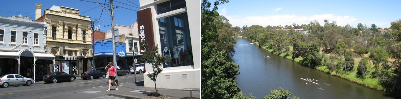
Extending along almost the entire 2 kilometre length of Bridge Street is the hub of Richmond's dining and retail centre. Mixed in between landmarks such as the striking structure of the Richmond Town Hall and several historic hotels are a multitude of eateries, bargain clothing stores, factory outlets and the Richmond Plaza Shopping Centre.
The colourful shopping and eating strip of Bridge Road is replicated on a slightly smaller scale along Richmond's other main thoroughfare of Swan Street. The Dimmeys department store is a landmark in Swan Street with its ornate clock tower, while also along the street are cafes, fashion stores, pubs and entertainment venues.
Richmond is home to a number of attractive parks and gardens. Just a few steps around the corner from bustling Bridge Street in Church Street is Citizens Park with its large sports oval and shady playground and picnic areas. Barkly Gardens, situated between Mary Street and Coppin Street, offer large expanses of lawn and tree-lined walkways. At the southern end of Mary Street is McConchie Reserve which overlooks wetlands and the Burnley Harbour, with access provided under the Monash Freeway to the Yarra River opposite Herring Island. Burnley Park is a large area of open space fronting the Yarra River and features sporting and recreational facilities.
The Yarra River forms the eastern and southern boundary of Richmond. Along the river's edge is the Capital City Trail walkway and bicycle track which skirts the edges of Richmond as part of its 32 kilometre loop around Melbourne's inner suburbs. The section of the Yarra River bordering Hawthorn to the east has carved out a deep gorge, offering a quiet and secluded oasis along the river which seems like worlds away from the surrounding city above. The southern section of the Yarra River, which defines the boundary between Richmond and South Yarra, winds its way through residential areas to the south while the northern bank is adjacent to the elevated roadway of the Monash Freeway. Along this northern bank is the Main Yarra Trail, consisting of a mixture of pathways along the river's grassy banks and floating sections of walkway along the edge of the river.