Southbank - public transport
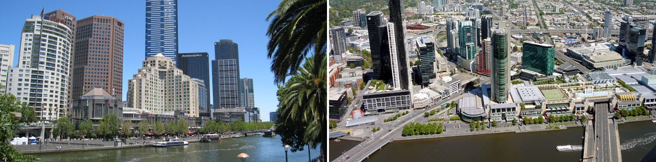
Southbank
Stay
See and do
Food and drink
Shopping
Getting around
Visitor information
Train
Flinders Street station
(1 km away)
| Line | Operator | Timetable and stops | Map |
|---|---|---|---|
| Alamein |  |
Alamein - Melbourne Via Alamein, Ashburton, Burwood, Hartwell, Willison, Riversdale, Camberwell, Auburn, Glenferrie, Hawthorn, Burnley, East Richmond, Richmond, Parliament, Melbourne Central, Flagstaff, Southern Cross, Flinders Street |
|
| Belgrave | |
Belgrave - Melbourne Via Belgrave, Tecoma, Upwey, Upper Ferntree Gully, Ferntree Gully, Boronia, Bayswater, Heathmont, Ringwood, Heatherdale, Mitcham, Nunawading, Blackburn, Laburnum, Box Hill, Union, Chatham, Canterbury, East Camberwell, Camberwell, Auburn, Glenferrie, Hawthorn, Burnley, East Richmond, Richmond, Parliament, Melbourne Central, Flagstaff, Southern Cross, Flinders Street |
|
| Craigieburn | |
Craigieburn - Melbourne Via Craigieburn, Roxburgh Park, Coolaroo, Broadmeadows, Jacana, Glenroy, Oak Park, Pascoe Vale, Strathmore, Glenbervie, Essendon, Moonee Ponds, Ascot Vale, Newmarket, Kensington, North Melbourne, Flagstaff, Melbourne Central, Parliament, Southern Cross, Flinders Street |
|
| Cranbourne | |
Cranbourne - Melbourne Via Cranbourne, Merinda Park, Lynbrook, Dandenong, Yarraman, Noble Park, Sandown Park, Springvale, Westall, Clayton, Huntingdale, Oakleigh, Hughesdale, Murrumbeena, Carnegie, Caulfield, Malvern, Armadale, Toorak, Hawksburn, South Yarra, Richmond, Parliament, Melbourne Central, Flagstaff, Southern Cross, Flinders Street |
|
| Frankston | |
Frankston - Melbourne Via Frankston, Kananook, Seaford, Carrum, Bonbeach, Chelsea, Edithvale, Aspendale, Mordialloc, Parkdale, Mentone, Cheltenham, Southland, Highett, Moorabbin, Patterson, Bentleigh, McKinnon, Ormond, Glen Huntly, Caulfield, Malvern, Armadale, Toorak, Hawksburn, South Yarra, Richmond, Flinders Street, Southern Cross |
|
| Glen Waverley | |
Glen Waverley - Melbourne Via Glen Waverley, Syndal, Mount Waverley, Jordanville, Holmesglen, East Malvern, Darling, Glen Iris, Gardiner, Tooronga, Kooyong, Heyington, Burnley, East Richmond, Richmond, Parliament, Melbourne Central, Flagstaff, Southern Cross, Flinders Street |
|
| Hurstbridge | |
Hurstbridge - Melbourne Via Hurstbridge, Wattle Glen, Diamond Creek, Eltham, Montmorency, Greensborough, Watsonia, Macleod, Rosanna, Heidelberg, Eaglemont, Ivanhoe, Darebin, Alphington, Fairfield, Dennis, Westgarth, Clifton Hill, Victoria Park, Collingwood, North Richmond, West Richmond, Jolimont, Flinders Street, Southern Cross, Flagstaff, Melbourne Central, Parliament |
|
| Lilydale | |
Lilydale - Melbourne Via Lilydale, Mooroolbark, Croydon, Ringwood East, Ringwood, Heatherdale, Mitcham, Nunawading, Blackburn, Laburnum, Box Hill, Union, Chatham, Canterbury, East Camberwell, Camberwell, Auburn, Glenferrie, Hawthorn, Burnley, East Richmond, Richmond, Parliament, Melbourne Central, Flagstaff, Southern Cross, Flinders Street |
|
| Mernda | |
Mernda - Melbourne Via Mernda, Hawkstowe, Middle Gorge, South Morang, Epping, Lalor, Thomastown, Keon Park, Ruthven, Reservoir, Regent, Preston, Bell, Thornbury, Croxton, Northcote, Merri, Rushall, Clifton Hill, Victoria Park, Collingwood, North Richmond, West Richmond, Jolimont, Flinders Street, Southern Cross, Flagstaff, Melbourne Central, Parliament |
|
| Pakenham | |
Pakenham - Melbourne Via Pakenham, Cardinia Road, Officer, Beaconsfield, Berwick, Narre Warren, Hallam, Dandenong, Yarraman, Noble Park, Sandown Park, Springvale, Westall, Clayton, Huntingdale, Oakleigh, Hughesdale, Murrumbeena, Carnegie, Caulfield, Malvern, Armadale, Toorak, Hawksburn, South Yarra, Richmond, Parliament, Melbourne Central, Flagstaff, Southern Cross, Flinders Street |
|
| Sandringham | |
Sandringham - Melbourne Via Sandringham, Hampton, Brighton Beach, Middle Brighton, North Brighton, Gardenvale, Elsternwick, Ripponlea, Balaclava, Windsor, Prahran, South Yarra, Richmond, Flinders Street, Southern Cross |
|
| Sunbury | |
Sunbury - Melbourne Via Sunbury, Diggers Rest, Watergardens, Keilor Plains, St Albans, Ginifer, Albion, Sunshine, Tottenham, West Footscray, Middle Footscray, Footscray, North Melbourne, Flagstaff, Melbourne Central, Parliament, Southern Cross, Flinders Street |
|
| Upfield | |
Upfield - Melbourne Via Upfield, Gowrie, Fawkner, Merlynston, Batman, Coburg, Moreland, Anstey, Brunswick, Jewell, Royal Park, Flemington Bridge, Macaulay, North Melbourne, Flagstaff, Melbourne Central, Parliament, Southern Cross, Flinders Street |
|
| Werribee | |
Werribee - Melbourne Via Werribee, Hoppers Crossing, Williams Landing, Aircraft, Laverton, Westona, Altona, Seaholme, Newport, Spotswood, Yarraville, Seddon, Footscray, South Kensington, North Melbourne, Southern Cross, Flinders Street |
|
| Williamstown | |
Williamstown - Melbourne Via Williamstown, Williamstown Beach, North Williamstown, Newport, Spotswood, Yarraville, Seddon, Footscray, South Kensington, North Melbourne, Southern Cross, Flinders Street |
|
| Traralgon |  |
Traralgon - Melbourne Via Traralgon, Morwell, Moe, Trafalgar, Yarragon, Warragul, Drouin, Longwarry, Bunyip, Garfield, Tynong, Nar Nar Goon, Pakenham, Berwick, Dandenong, Clayton, Caulfield, Richmond, Flinders Street, Southern Cross |
|
| Bairnsdale | |
Bairnsdale - Melbourne Via Bairnsdale, Stratford, Sale, Rosedale, Traralgon, Morwell, Moe, Warragul, Drouin, Garfield, Pakenham, Dandenong, Caulfield, Richmond, Flinders Street, Southern Cross |
Southern Cross station
(2 km away)
| Line | Operator | Timetable and stops | Map |
|---|---|---|---|
| Alamein | |
Alamein - Melbourne Via Alamein, Ashburton, Burwood, Hartwell, Willison, Riversdale, Camberwell, Auburn, Glenferrie, Hawthorn, Burnley, East Richmond, Richmond, Parliament, Melbourne Central, Flagstaff, Southern Cross, Flinders Street |
|
| Belgrave | |
Belgrave - Melbourne Via Belgrave, Tecoma, Upwey, Upper Ferntree Gully, Ferntree Gully, Boronia, Bayswater, Heathmont, Ringwood, Heatherdale, Mitcham, Nunawading, Blackburn, Laburnum, Box Hill, Union, Chatham, Canterbury, East Camberwell, Camberwell, Auburn, Glenferrie, Hawthorn, Burnley, East Richmond, Richmond, Parliament, Melbourne Central, Flagstaff, Southern Cross, Flinders Street |
|
| Craigieburn | |
Craigieburn - Melbourne Via Craigieburn, Roxburgh Park, Coolaroo, Broadmeadows, Jacana, Glenroy, Oak Park, Pascoe Vale, Strathmore, Glenbervie, Essendon, Moonee Ponds, Ascot Vale, Newmarket, Kensington, North Melbourne, Flagstaff, Melbourne Central, Parliament, Southern Cross, Flinders Street |
|
| Cranbourne | |
Cranbourne - Melbourne Via Cranbourne, Merinda Park, Lynbrook, Dandenong, Yarraman, Noble Park, Sandown Park, Springvale, Westall, Clayton, Huntingdale, Oakleigh, Hughesdale, Murrumbeena, Carnegie, Caulfield, Malvern, Armadale, Toorak, Hawksburn, South Yarra, Richmond, Parliament, Melbourne Central, Flagstaff, Southern Cross, Flinders Street |
|
| Frankston | |
Frankston - Melbourne Via Frankston, Kananook, Seaford, Carrum, Bonbeach, Chelsea, Edithvale, Aspendale, Mordialloc, Parkdale, Mentone, Cheltenham, Southland, Highett, Moorabbin, Patterson, Bentleigh, McKinnon, Ormond, Glen Huntly, Caulfield, Malvern, Armadale, Toorak, Hawksburn, South Yarra, Richmond, Flinders Street, Southern Cross |
|
| Glen Waverley | |
Glen Waverley - Melbourne Via Glen Waverley, Syndal, Mount Waverley, Jordanville, Holmesglen, East Malvern, Darling, Glen Iris, Gardiner, Tooronga, Kooyong, Heyington, Burnley, East Richmond, Richmond, Parliament, Melbourne Central, Flagstaff, Southern Cross, Flinders Street |
|
| Hurstbridge | |
Hurstbridge - Melbourne Via Hurstbridge, Wattle Glen, Diamond Creek, Eltham, Montmorency, Greensborough, Watsonia, Macleod, Rosanna, Heidelberg, Eaglemont, Ivanhoe, Darebin, Alphington, Fairfield, Dennis, Westgarth, Clifton Hill, Victoria Park, Collingwood, North Richmond, West Richmond, Jolimont, Flinders Street, Southern Cross, Flagstaff, Melbourne Central, Parliament |
|
| Lilydale | |
Lilydale - Melbourne Via Lilydale, Mooroolbark, Croydon, Ringwood East, Ringwood, Heatherdale, Mitcham, Nunawading, Blackburn, Laburnum, Box Hill, Union, Chatham, Canterbury, East Camberwell, Camberwell, Auburn, Glenferrie, Hawthorn, Burnley, East Richmond, Richmond, Parliament, Melbourne Central, Flagstaff, Southern Cross, Flinders Street |
|
| Mernda | |
Mernda - Melbourne Via Mernda, Hawkstowe, Middle Gorge, South Morang, Epping, Lalor, Thomastown, Keon Park, Ruthven, Reservoir, Regent, Preston, Bell, Thornbury, Croxton, Northcote, Merri, Rushall, Clifton Hill, Victoria Park, Collingwood, North Richmond, West Richmond, Jolimont, Flinders Street, Southern Cross, Flagstaff, Melbourne Central, Parliament |
|
| Pakenham | |
Pakenham - Melbourne Via Pakenham, Cardinia Road, Officer, Beaconsfield, Berwick, Narre Warren, Hallam, Dandenong, Yarraman, Noble Park, Sandown Park, Springvale, Westall, Clayton, Huntingdale, Oakleigh, Hughesdale, Murrumbeena, Carnegie, Caulfield, Malvern, Armadale, Toorak, Hawksburn, South Yarra, Richmond, Parliament, Melbourne Central, Flagstaff, Southern Cross, Flinders Street |
|
| Sandringham | |
Sandringham - Melbourne Via Sandringham, Hampton, Brighton Beach, Middle Brighton, North Brighton, Gardenvale, Elsternwick, Ripponlea, Balaclava, Windsor, Prahran, South Yarra, Richmond, Flinders Street, Southern Cross |
|
| Sunbury | |
Sunbury - Melbourne Via Sunbury, Diggers Rest, Watergardens, Keilor Plains, St Albans, Ginifer, Albion, Sunshine, Tottenham, West Footscray, Middle Footscray, Footscray, North Melbourne, Flagstaff, Melbourne Central, Parliament, Southern Cross, Flinders Street |
|
| Upfield | |
Upfield - Melbourne Via Upfield, Gowrie, Fawkner, Merlynston, Batman, Coburg, Moreland, Anstey, Brunswick, Jewell, Royal Park, Flemington Bridge, Macaulay, North Melbourne, Flagstaff, Melbourne Central, Parliament, Southern Cross, Flinders Street |
|
| Werribee | |
Werribee - Melbourne Via Werribee, Hoppers Crossing, Williams Landing, Aircraft, Laverton, Westona, Altona, Seaholme, Newport, Spotswood, Yarraville, Seddon, Footscray, South Kensington, North Melbourne, Southern Cross, Flinders Street |
|
| Williamstown | |
Williamstown - Melbourne Via Williamstown, Williamstown Beach, North Williamstown, Newport, Spotswood, Yarraville, Seddon, Footscray, South Kensington, North Melbourne, Southern Cross, Flinders Street |
|
| Traralgon | |
Traralgon - Melbourne Via Traralgon, Morwell, Moe, Trafalgar, Yarragon, Warragul, Drouin, Longwarry, Bunyip, Garfield, Tynong, Nar Nar Goon, Pakenham, Berwick, Dandenong, Clayton, Caulfield, Richmond, Flinders Street, Southern Cross |
|
| Bairnsdale | |
Bairnsdale - Melbourne Via Bairnsdale, Stratford, Sale, Rosedale, Traralgon, Morwell, Moe, Warragul, Drouin, Garfield, Pakenham, Dandenong, Caulfield, Richmond, Flinders Street, Southern Cross |
|
| Seymour | |
Seymour - Melbourne Via Seymour, Tallarook, Broadford, Kilmore East, Wandong, Heathcote Junction, Wallan, Donnybrook, Craigieburn, Broadmeadows, Essendon, North Melbourne, Southern Cross |
|
| Shepparton | |
Shepparton - Melbourne Via Shepparton, Mooroopna, Murchison East, Nagambie, Seymour, Tallarook, Broadford, Kilmore East, Wandong, Heathcote Junction, Wallan, Donnybrook, Broadmeadows, Essendon, North Melbourne, Southern Cross |
|
| Albury - Wodonga | |
Albury (NSW) - Melbourne Via Albury (NSW), Wodonga, Chiltern, Springhurst, Wangaratta, Benalla, Violet Town, Euroa, Avenel, Seymour, Broadmeadows, Essendon, North Melbourne, Southern Cross |
|
| Bendigo | |
Bendigo - Melbourne Via Epsom or Eaglehawk, Bendigo, Kangaroo Flat, Castlemaine, Malmsbury, Kyneton, Woodend, Macedon, Gisborne, Riddells Creek, Clarkefield, Sunbury, Watergardens, Footscray, Southern Cross |
|
| Swan Hill | |
Swan Hill - Melbourne Via Swan Hill, Kerang, Pyramid, Dingee, Raywood, Eaglehawk, Bendigo, Kangaroo Flat, Castlemaine, Malmsbury, Kyneton, Woodend, Gisborne, Watergardens, Footscray, Southern Cross |
|
| Echuca | |
Echuca - Melbourne Via Echuca, Rochester, Elmore, Goornong, Huntly, Epsom, Bendigo, Kangaroo Flat, Castlemaine, Malmsbury, Kyneton, Woodend, Macedon, Gisborne, Riddells Creek, Clarkefield, Sunbury, Footscray, Southern Cross |
|
| Ballarat | |
Ballarat - Melbourne Via Wendouree, Ballarat, Ballan, Bacchus Marsh, Melton, Cobblebank, Rockbank, Caroline Springs, Deer Park, Ardeer, Sunshine, Footscray, Southern Cross |
|
| Ararat | |
Ararat - Melbourne Via Ararat, Beaufort, Wendouree, Ballarat, Ballan, Bacchus Marsh, Melton, Cobblebank, Rockbank, Caroline Springs, Deer Park, Ardeer, Sunshine, Footscray, Southern Cross |
|
| Geelong | |
Geelong - Melbourne Via Waurn Ponds, Marshall, South Geelong, Geelong, North Geelong, North Shore, Corio, Lara, Little River, Wyndham Vale, Tarneit, Deer Park, Ardeer, Sunshine, Footscray, Southern Cross |
|
| Warrnambool | |
Warrnambool - Melbourne Via Warrnambool, Sherwood Park, Terang, Camperdown, Colac, Birregurra, Winchelsea, Waurn Ponds, Marshall, South Geelong, Geelong, North Geelong, North Shore, Corio, Lara, Little River, Wyndham Vale, Tarneit, Footscray, Southern Cross |
|
| The Overland |  |
Melbourne to Adelaide Via Southern Cross, North Shore, Ararat, Stawell, Horsham, Dimboola, Nhill, Bordertown (SA), Murray Bridge (SA), Adelaide (SA) |
|
| Southern XPT |  |
Melbourne to Sydney Via Southern Cross, Broadmeadows, Seymour, Benalla, Wangaratta, Albury (NSW), Culcairn (NSW), Henty (NSW), The Rock (NSW), Wagga Wagga (NSW), Junee (NSW), Cootamundra(NSW), Harden (NSW), Yass Junction (NSW), Gunning (NSW), Goulburn (NSW), Moss Vale (NSW), Campbelltown (NSW), Sydney (NSW) |
Tram
Bus
| Route | Operator | Timetable | Map |
|---|---|---|---|
| No. 234: Melbourne CBD to Port Melbourne Via Southbank, South Melbourne |
Kinetic Melbourne | ||
| No. 236: Melbourne CBD to Port Melbourne Via Southbank, South Melbourne, Albert Park |
Kinetic Melbourne | ||
| No. 237: Melbourne CBD to Port Melbourne Via Southbank, Docklands, Southern Cross station |
Kinetic Melbourne | ||
| No. 605: Melbourne CBD to Gardenvale Via Southbank, South Yarra, Toorak, Toorak station, Armadale, Armadale station, Caulfield, Elsternwick |
CDC Victoria |
Ferry


Air
| Airport | Distance | Destinations | Airlines |
|---|---|---|---|
| Melbourne (Tullamarine) |
22 km | Within Australia | |
| International |
|
||
| Essendon Fields | 14 km |
|
|
| Avalon (Geelong) |
54 km |
|