Tooradin
Tooradin
Stay
See and do
Food and drink
Shopping
Getting around
Visitor information
The small township of Tooradin is situated on the northern shoreline of Western Port and makes an ideal stopping point for those journeying between Melbourne and Phillip Island.
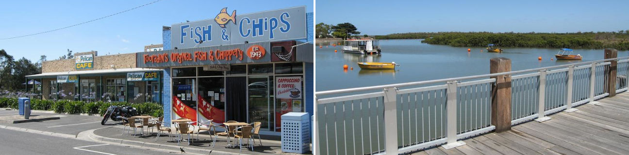
Tooradin's commercial centre is spread out along both sides of the South Gippsland Highway and includes a selection of cafes, take-away outlets, restaurants, a hotel and supermarket.
Flowing through Tooradin is the tidal channel of Sawtells Inlet which meanders through pleasant parkland north of the highway. South of the highway, the inlet flows into Western Port. The eastern shore of the inlet caters for water enthusiasts and visitors with a boat ramp, jetty, a reserve with picnic and BBQ facilities, a boardwalk and a coastal lookout which provides panoramic views over the surrounding mudflats and mangroves. A wooden footbridge spans the inlet just south of the highway, with the sculpture of a dolphin fish located on the western shoreline. This sculpture was originally used as part of an aquatic display for the 2006 Melbourne Commonwealth Games. North of the highway, Sawtells Inlet forms what resembles a lake surrounded by parkland, with walking tracks and a footbridge.
Tooradin has long been a popular fishing spot. Near the main jetty on Foreshore Road is an original fisherman's weatherboard cottage which now operates as a museum, showcasing items of local history.
Four kilometres east of Tooradin on the South Gippsland Highway is the town's airfield which offers scenic flights and skydiving. The airfield's restaurant is open to the public and specialises in seafood.
A few kilometres further east on the highway at the Bunyip River are fresh food stalls, a picnic area and the Swamp Lookout Tower which offers views over the surrounding farmland.