Warragul - public transport
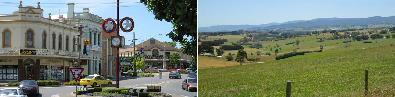
Warragul
Stay
See and do
Food and drink
Shopping
Getting around
Visitor information
Train
Warragul station
| Line | Operator | Timetable and stops | Map |
|---|---|---|---|
| Traralgon |  |
Traralgon - Melbourne Via Traralgon, Morwell, Moe, Trafalgar, Yarragon, Warragul, Drouin, Longwarry, Bunyip, Garfield, Tynong, Nar Nar Goon, Pakenham, Berwick, Dandenong, Clayton, Caulfield, Richmond, Flinders Street, Southern Cross |
|
| Bairnsdale | |
Bairnsdale - Melbourne Via Bairnsdale, Stratford, Sale, Rosedale, Traralgon, Morwell, Moe, Warragul, Drouin, Garfield, Pakenham, Dandenong, Caulfield, Richmond, Flinders Street, Southern Cross |
Bus
| Route | Operator | Timetable | Map |
|---|---|---|---|
| No. 80: Warragul to Warragul South Via Warragul station, West Gippsland Hospital |
Warragul Bus Lines | ||
| No. 81: Warragul to Warragul North Via Warragul station |
Warragul Bus Lines | ||
| No. 82: Warragul to Warragul North Via Warragul station |
Warragul Bus Lines | ||
| No. 83: Warragul to Warragul East Via Warragul station |
Warragul Bus Lines | ||
| No. 85: Drouin to Warragul Via Drouin station, Warragul station |
Warragul Bus Lines | ||
| No. 89: Warragul to Noojee Via Warragul station, Buln Buln, Rokeby, Neerim South, Neerim, Neerim Junction |
Warragul Bus Lines | ||
| Drouin to Traralgon Via Drouin station, Warragul, Warragul station, Nilma, Darnum, Yarragon station, Trafalgar station, Trafalgar, Moe station, Morwell station, Morwell, Traralgon station |
Warragul Bus Lines | ||
| Drouin to Warragul Via Drouin station, Warragul station |
Warragul Bus Lines | ||
| Drouin to Newborough Via Drouin station, Warragul, Warragul station, Nilma, Darnum, Yarragon station, Trafalgar station, Trafalgar, Moe station, Federation Training Yallourn |
Warragul Bus Lines | ||
| Drouin to Moe Via Drouin station, Warragul, Warragul station, Nilma, Darnum, Yarragon station, Trafalgar station, Trafalgar, Moe station |
Warragul Bus Lines | ||
| Drouin to Warragul Via Drouin station, Warragul station |
Warragul Bus Lines | ||
| Garfield to Traralgon Via Garfield station, Bunyip, Longwarry station, Drouin, Drouin station, Warragul, Warragul station, Nilma, Darnum, Yarragon station, Trafalgar station, Trafalgar, Moe station, Federation Training Yallourn, Morwell station, Morwell, Traralgon station |
Warragul Bus Lines | ||
| Moe to Drouin Via Moe station, Trafalgar, Yarragon station, Darnum, Nilma, Warragul station, Warragul, Drouin station |
Warragul Bus Lines | ||
| Moe to Garfield Via Moe station, Trafalgar, Yarragon station, Darnum, Nilma, Warragul station, Warragul, Drouin station, Drouin, Longwarry station, Bunyip, Garfield station |
Warragul Bus Lines | ||
| Newborough to Drouin Via Federation Training Yallourn, Moe station, Trafalgar, Yarragon station, Darnum, Nilma, Warragul station, Warragul, Drouin station |
Warragul Bus Lines | ||
| Warragul to Moe Via Warragul station, Nilma, Darnum, Yarragon station, Trafalgar station, Trafalgar, Moe station |
Warragul Bus Lines | ||
| Warragul to Moe Via Warragul station, Nilma, Darnum, Yarragon station, Trafalgar station, Trafalgar, Moe station |
Warragul Bus Lines | ||
| Traralgon to Drouin Via Traralgon station, Morwell, Morwell station, Federation Training Yallourn, Moe station, Trafalgar, Trafalgar station, Yarragon station, Darnum, Nilma, Warragul station, Warragul, Drouin station |
Warragul Bus Lines | ||
| Traralgon to Drouin Via Traralgon station, Morwell, Morwell station, Moe station, Trafalgar, Yarragon station, Darnum, Nilma, Warragul station, Warragul, Drouin station |
Warragul Bus Lines | ||
| Warragul to Drouin Via Warragul station, Drouin station |
Warragul Bus Lines | ||
| Warragul to Pakenham Via Warragul station, Warragul, Drouin station, Drouin, Longwarry, Bunyip, Garfield station, Tynong station, Nar Nar Goon station, Pakenham station |
Warragul Bus Lines | ||
| Warragul to Drouin Via Warragul station, Drouin station |
Warragul Bus Lines | ||
| Warragul to Poowong East Via Warragul station, Drouin station, Drouin South, Ripplebrook, Poowong |
Warragul Bus Lines |
Taxi
| Operator | Areas covered | Phone |
|---|---|---|
| Baw Baw Taxis | Drouin, Warragul | 0455 722 248 |