Apollo Bay
Apollo Bay
Stay
See and do
Food and drink
Shopping
Getting around
Visitor information
Apollo Bay is located between Wye River and Cape Otway on Victoria's scenic coastal route, the Great Ocean Road.
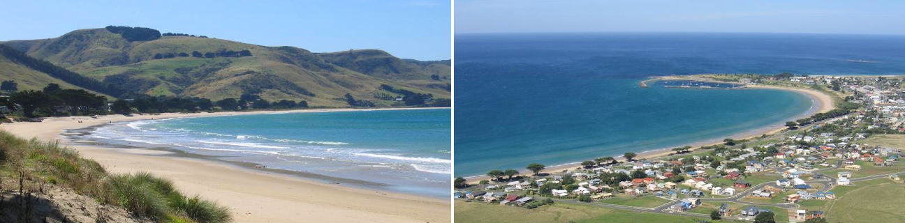
As a popular tourist destination, Apollo Bay offers both swimming and surf beaches, as well as a large boat harbour and marina which is home to a major fishing fleet. The town's commercial centre, which features a good selection of restaurants and cafes, is situated along one side of the Great Ocean Road, overlooking a wide, grassy foreshore which fronts the main swimming beach. Another popular beach is located at the mouth of the Barham River in Mounts Bay.
Overlooking Apollo Bay are rolling green hills, which create quite a scenic backdrop when viewed from the beach, foreshore and shops. Panoramic views can be enjoyed from the Marriners Lookout, located at the northern end of town off Marriners Lookout Road. It's a short walk from the car park along a scenic mountainside pathway to the lookout where there are views of Apollo Bay's town centre, the harbour and beaches up and down the coast. Under certain weather conditions the silhouette of the SS Casino, a steamship which sank in 1932 while trying to dock at Apollo Bay, can be seen in the waters close to the shore when looking eastwards over the caravan park.
A couple of museums are worth exploring in Apollo Bay. There is the Bass Strait Shell Museum, at the golf course end of town, offering a good collection of local and overseas shells, coral and preserved sea life specimens. The Old Cable Station Museum, on the Great Ocean Road at the northern edge of Apollo Bay, features collections of local memorabilia housed in the former cable station which was used for communications between Tasmania and the Australian mainland.
A popular scenic drive is along the Barham River Road which follows the Barham River inland from the coast through the lush rainforest of the Barham Valley, eventually ending up at the Marriners Falls. The small seaside community of Marengo is located just south of Apollo Bay on the other side of the Barham River and it offers quiet, sandy beaches. A 5 kilometre drive north of Apollo Bay on the Great Ocean Road takes you to Skenes Creek, which is another small and scenic seaside community. Fantastic views of the coast can be enjoyed at Evans Lookout, a couple of kilometres inland from Skenes Creek on the main road to Forrest and Colac.
The rugged and bushy Great Otway National Park, which includes a lighthouse at Cape Otway, is easily accessible, making Apollo Bay a great place to enjoy the coast and the bushy hinterland of the Otway Ranges.