Horsham
Horsham
Stay
See and do
Food and drink
Shopping
Getting around
Visitor information
Horsham is the largest city in the Wimmera wheat growing and sheep grazing district in western Victoria. It is located between Stawell and Dimboola, on the main highway linking Melbourne and Adelaide.
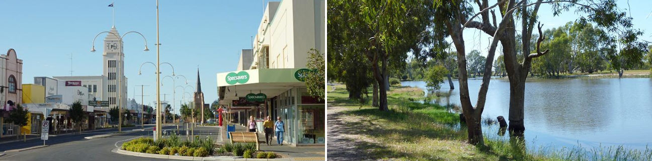
Horsham features a large commercial centre that lines much of Firebrace Street and extends into adjoining streets. The Horsham Plaza Shopping Centre can be found at the junction of Darlot Street and Wilson Street. Also located within the town centre are a number of cultural attractions including the Horsham Art Gallery which specialises in Australian photography, and several performing arts venues.
There are several attractive parks and gardens in Horsham. At the top end of Darlot Street is May Park with its distinctive palm trees, manicured lawns, playground and BBQ shelters. The Horsham Botanic Gardens, towards the southern end of Firebrace Street, were designed by William Guilfoyle, the curator of the Melbourne Botanic Gardens, and established in 1873. They occupy a 16 hectare site along the northern side of the Wimmera River and consist of formal gardens, wetlands, shaded lawns, woodlands, a lake and recreational facilities.
The Wimmera River flows through the southern end of Horsham, with the only road crossing in town being the twin bridges of the Western Highway. Parkland and ancient red gums line much of the river, and there are several boat ramps and picnic areas. At the end of Baillie Street is a native grass reserve which overlooks the river in Horsham's eastern fringe. To the west, stroll or pedal along the scenic Lawrie Rudolph Walk as it follows the path of the Wimmera River along its northern bank. Points of interest along the way include a major major war memorial, a sound shell, Apex Island which can be accessed via a footbridge, several boat ramps and picnic areas. Towards the western end of Barnes Boulevard are the extensive lawns of Weir Park where a weir has been built across the river. On the downstream side of the weir are walking tracks and a boardwalk through the surrounding wetlands.
Surrounding Horsham are vast wheat fields, pastoral land, and colourful fields of wildflowers. To the south-east, along the Western Highway, are the Wimmera Lakes which form part of the Wimmera-Mallee irrigation system. Green Lake, on the southern side of the highway, has a picnic area overlooking the lake and includes a boat ramp, jetty and swimming beach. Taylors Lake, a few kilometres north of the highway, is a recreational lake suitable for fishing, boating and swimming.
Horsham is a handy base to explore the region's nearby natural attractions. The northern extremity of the Grampians National Park is located 25 kilometres south-east of Horsham, while the the Little Desert National Park can be accessed via a number of small towns to the west and north-west. Mount Arapiles, less than 35 kilometres west of Horsham via Natimuk, is widely regarded as one of the top rock climbing areas in Australia and is also a great location for bushwalking and camping.