Wodonga
Wodonga
Stay
See and do
Food and drink
Shopping
Getting around
Visitor information
Wodonga is situated on the southern side of the Murray River on the main transport route between Melbourne and Sydney. Its larger "twin" city of Albury is located on the other side of the river in New South Wales.
Wodonga was founded in 1852, becoming an important river port for nearby Victorian goldfields, and the first bridge across the Murray River was built in 1860. In 1947, a migrant camp was established east of Wodonga at Bonegilla as part of the government's post-war migration scheme. During its 24 years of operation, a total of 320,000 people from 31 different ethnic backgrounds were temporarily housed at this reception centre. Today, just one of the 24 accommodation blocks and administration buildings remain on this 130 hectare site, and an interpretive centre has been built onto it which provides a vivid insight into the life of new arrivals to Australia.
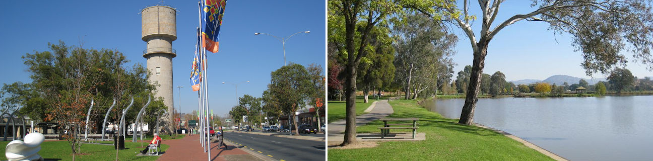
Wodonga has a large shopping precinct, primarily split between the Wodonga Plaza Shopping Centre on Elgin Boulevard and the shops along much of the length of High Street. Near the southern end of High Street is an attractive triangular park known as Woodland Grove which features a 33 metre high water tower (built in 1923), war memorial, sculptures, paved pathways and a cafe overlooking the lawns. High Street leads to a large 6-way roundabout with gardens in its centre, and then becomes the wide boulevard known as Beechworth Road with lawns and trees planted along its central strip.
There are a large selection of attractive parks and reserves throughout Wodonga, many situated along the numerous waterways in residential areas and incorporating a network of walking and bicycle tracks. Several of the larger parks feature a mixture of native and deciduous trees, particularly stunning in autumn when the leaves turn bright shades of orange and yellow. Sumsion Gardens, located just west of High Street at the northern end of the town centre, is surrounded a large lagoon. There is a walking track which goes right around the lake, plus picnic and BBQ facilities, shelters, a playground, and a rotunda accessed via a footbridge to a small island located within the lake.
Wodonga is separated from Albury by Gateway island which is surrounded by the Murray River and Wodonga Creek. On the island is the Gateway Village which includes art galleries, souvenir and craft outlets, a theatre, the old Customs House building (now a cafe) and a number of walking trails through the surrounding parkland, bush and beside the river. The state border between Victoria and New South Wales is located at the northern end of Gateway Island where Union Bridge crosses the Murray River. Take a short walk along a pathway from the Gateway Village past Byrne Lagoon to access the border crossing, or if driving through, stop at the car park (accessible by Wodonga-bound traffic only) just south of the bridge and take a stroll across the bridge to view the river. The entrance to the City of Wodonga at this point is marked by three brightly coloured spheres known as Porta, created by a local sculptor.
Wodonga is located within a short drive of several regional attractions including the wineries of Rutherglen and the historic towns of Chiltern, Beechworth and Yackandandah. For a longer scenic drive, follow the Murray Valley Highway eastwards out to Corryong or take the longer route via the Murray River Road which follows the river along its natural and picturesque upper reaches.