Paynesville
Paynesville
Stay
See and do
Food and drink
Shopping
Getting around
Visitor information
Paynesville is located 17 kilometres south of Bairnsdale within the Gippsland Lakes system and with direct access to both Lake King and Lake Victoria.
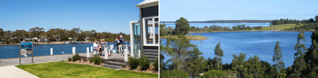
Paynesville is a popular boating location, effectively surrounded on three sides by water. There are extensive lawns, stretches of sand, boat ramps and a pier along the southern shoreline. The eastern shoreline along McMillans Strait also includes lawn areas but is more geared towards boating with several marinas, jetties and Fishermans Wharf with its waterfront cafe and restaurant.
Paynesville's commercial centre is located on the inland side of Esplanade, thus it overlooks the beautiful waterways and foreshore just across the road.
St Peters Anglican Church is located in an elevated position on Sunset Drive, overlooks the surrounding lake. It has been architecturally designed to resemble a ship and was built from Gippsland limestone bricks in 1961.
200 metres off the coast of Paynesville and linked to the town by a vehicular ferry is Raymond Island. The island has a small residential population which co-exists with many native birds and animals, offering ideal bushwalking opportunities.
Just north of Paynesville, at Eagle Point, the Mitchell River enters Lake King. Bluff Lookout provides good views over the lake, river and surrounding countryside.
At the mouth of the Mitchell River there are two 8 kilometre long and narrow peninsulas of land known as the Silt Jetties which stretch out into the lake. They was formed over millions of years by sediment in the river being deposited along the river's mouth as the waters slowed when reaching the lakes system. They are reported to be the second largest of their type in the world, and visitors can drive along a narrow dirt road along one of the jetties to its end.