Wye River
Wye River
Stay
See and do
Food and drink
Shopping
Getting around
Visitor information
Wye River is situated between Lorne and Apollo Bay, along one of the most spectacular sections of the Great Ocean Road.
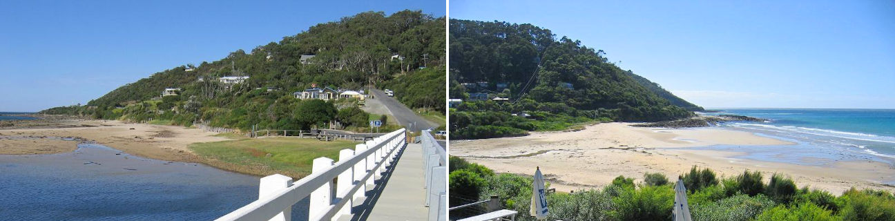
Wye River is a small coastal town, located on the river it's named after, with a rugged and bushy mountain backdrop. It's where the rainforest meets the sea and well-noted for its wildlife, beaches and scenery. There's a general store located beside the river, and the town's hotel is perched high above the beach, offering visitors great views while eating and drinking.
The main sandy beach near the river mouth is patrolled during the warmer months of the year, while the surrounding rocky platforms, rock pools and reefs are great for fishing and exploring.
Scenic views can be enjoyed from Point Sturt, at the southern end of Wye River. The remains of piers built between 1899 and 1910 over the beach and rocks can be observed from here.
Just to the north of Wye River is the tiny residential settlement of Separation Creek where there are secluded sandy bays, rocky sections of coastline and good views from the Great Ocean Road.
5 kilometres south of Wye River and nestled at the base of the surrounding bushy hills is the small coastal community of Kennett River. Near the general store is parkland and a wetlands reserve which fronts the Kennett River. Good views along the coast can be experienced from Point Hawdon, located on the Great Ocean Road at the southern end of town. Take a drive along Grey River Road which extends inland into the Great Otway National Park. This is a good spot to view koalas in gum trees beside the road. The Grey River Reserve picnic area is located around 6 kilometres along the road and includes a fern walk through untouched forest.
A few kilometres south of Kennett River is the Cape Patton Lookout. It provides panoramic views towards Apollo Bay where the rugged and bushy cliff tops of the Great Otway National Park give way to a more open and undulating coastal landscape.