Bairnsdale
Bairnsdale
Stay
See and do
Food and drink
Shopping
Getting around
Visitor information
Bairnsdale is the largest city in the East Gippsland region, situated on the Mitchell River which then flows into the extensive Gippsland Lakes system at Lake King.
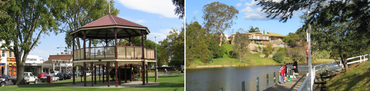
Bairnsdale's large and busy commercial centre is built around the Princes Highway which opens up into a wide boulevard featuring trees, gardens and a rotunda in the central strip. Landmarks in the commercial centre include the impressive St Mary's Catholic Church (built between 1913 and 1937), the courthouse in Nicholson Street (1894), the town's water tower, and a number of historic shops and hotels.
Several parks front the Mitchell River, including the park at the old river port behind the post office, offering BBQ and picnic facilities as well as a jetty. Fishing and boating jetties are also located on the west bank of the Mitchell River, just south of the Princes Highway on the road to Paynesville.
The McLeods Morass State Game Reserve is a 520 hectare park situated in wetlands, rich in animal life and featuring a boardwalk, birdhide and a number of walking tracks. Access is via Saleyards Road.
Bairnsdale is at the southern end-point of the Great Alpine Road which traverses the Great Dividing Range, and passes through the peaceful village of Bruthen, ascends to the remote Snowy Mountains town of Omeo, the alpine resort of Mount Hotham, the all year round holiday town of Bright, and finally ending up at the large north-eastern Victorian regional city of Wangaratta, over 300 kilometres away.