Healesville
Healesville
Stay
See and do
Food and drink
Shopping
Getting around
Visitor information
Healesville is located in Melbourne's scenic Yarra Valley, east of Yarra Glen and north-east of Lilydale.
Growth first occurred in Healesville due a track being constructed through the area to the booming Woods Point goldfields, with the town first being surveyed in 1864. Farming and timber production were some of Healesville's first industries, while the arrival of the railway in 1889 transforming the town into a tourist destination and a place for holidaymakers from Melbourne to journey to.
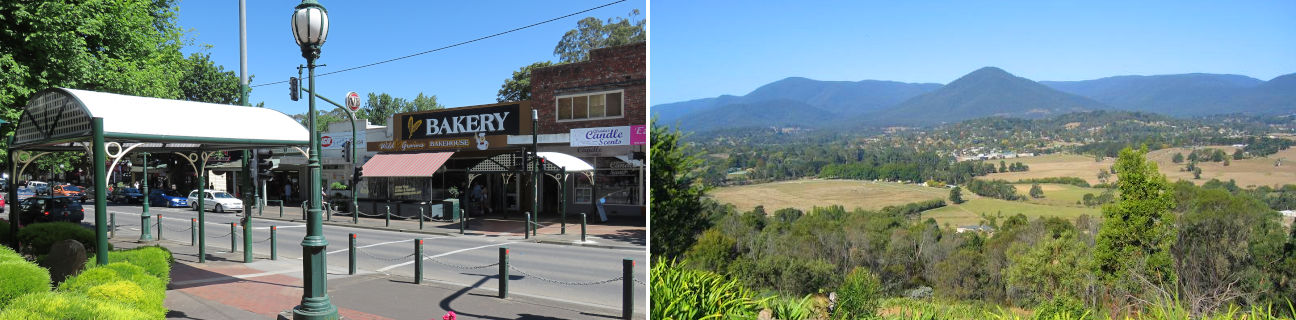
These days, Healesville is still a major tourist destination, located in the famous Yarra Valley grape growing region. The town is surrounded by mountains, forests and rolling hills dotted with wineries, fruit and berry farms.
Enjoy scenic views of Healesville, Mount Riddell and the surrounding valleys by driving along Yarra Glen Road west of the racecourse. The route north along St Leonards Road and Myers Creek Road winds its way past a number of fruit and berry farms.
The commercial centre of Healesville is situated along the shady tree-lined boulevard of Nicholson Street, which features a large selection of speciality shops, hotels, cafes, and a modern shopping complex built around a major supermarket.
Just north-east of town is the Maroondah Reservoir, which offers colourful gardens, BBQ and picnic areas, and path along the elevated dam wall provides panoramic views of the surrounding mountains. Four kilometres south of the town centre is the Healesville Sanctuary which first opened in 1934 and features an impressive collection of birds, mammals and reptiles. Badger Weir Park, located 3 kilometres east of the Healesville Sanctuary, features a weir, landscaped picnic areas with rotundas, and walking trails through fern gullies and forests.
A popular scenic drive is north-east along the Maroondah Highway through the dense forests at Black Spur towards Marysville.