Mildura
Mildura
Stay
See and do
Food and drink
Shopping
Getting around
Visitor information
Mildura is located in the far north-western corner of Victoria, on the banks of the Murray River, around 400 kilometres from Adelaide and under 550 kilometres from Melbourne.
Originally a rather lifeless area, the region around Mildura was transformed into a rich agricultural oasis thanks to the work of the Chaffey brothers from Canada in the late 1800s due to their experience with creating irrigation settlements.
Mildura is a popular tourist destination and a bustling regional city in an area well noted for its warm and stable weather. It features wide, tree-lined streets and is surrounded by vast numbers of wineries and fruit growing farms.
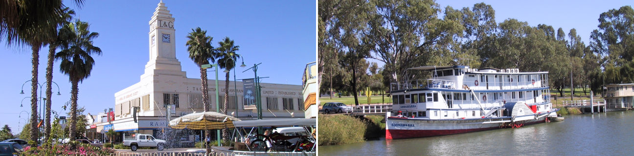
The commercial centre of Mildura extends along the grand boulevard of Deakin Avenue with gardens and monuments located along its wide central strip. Running parallel to Deakin Avenue is Langtree Avenue which features an attractive pedestrian-only mall between 8th Street and 9th Street. The section of Langtree Avenue between 7th Street and 8th Street is nicknamed "Feast Street" due to its concentration of restaurants, cafes and bars.
Mildura's famous natural attraction is the Murray River which offers many activities, such as paddle steamer cruises which depart from the wharf, swimming, fishing and the popular activity of living on a hired house boat and cruising along the river for a number of days.
Mildura's rich history can be uncovered by following the Chaffey Trail - a self-guided historical tour. See the Old Mildura Homestead in Cureton Avenue, built in 1847 and known as the landmark where the vision of irrigation evolved. Rio Vista House, a Spanish masterpiece built in 1890 in Queen Anne style architecture, was the home of the Chaffeys and has been restored to its original condition. The Mildura Wharf provides a first-hand experience of 19th century river travel where visitors can take a paddlesteamer ride. Mildura's Grand Hotel began life as a coffee house in 1891 until it became the town's first pub in 1918. Chateau Mildura, an 1888 homestead located in nearby Irymple, was the catalyst for the set up of the region's wine industry.
There are two noteworthy towns that are situated on the outskirts of Mildura.
Merbein is 11 kilometres from the centre of Mildura, to the west. Known as the town of wine, vines and citrus, it is surrounded by thousands of hectares of irrigated farmland. Merbein's main shopping strip spans a section of Commercial Street and includes a supermarket, retailers and food outlets. The Murray River is located 2 kilometres from the heart of Merbein and a good vantage point is at the lookout off Forbes Drive. Situated above "white cliffs" - the original name of the town - the lookout offers panoramic views along the river and across the surrounding bushland can be enjoyed.
16 kilometres south of Mildura's city centre is the town of Red Cliffs. It s located within a major citrus and grape growing district, sustained by irrigation from the Murray River. The commercial centre of Red Cliffs is centred around Indi Avenue and Ilex Street. Big Lizzie, a 45 tonne steam tractor which started clearing the surrounding land for farming in 1920, has been preserved in adjacent Barclay Square. A short journey eastwards along Pumps Road leads to the Red Cliffs Scenic Reserve where the cliff top lookout commands fine views over the river and surrounding landscape. Nearby is a pumping station which draws water from the Murray River up over the cliffs and into a network of irrigation channels.
Mildura is the perfect base for exploring other locations in this area. A 90 minute drive west will take you into South Australia's rich Murray Riverland region surrounding Renmark and Berri. 30 kilometres north-west of Mildura is the historic port town of Wentworth in New South Wales, where the Murray River meets the Darling River, at the gateway to a vast outback region.