St Arnaud - public transport
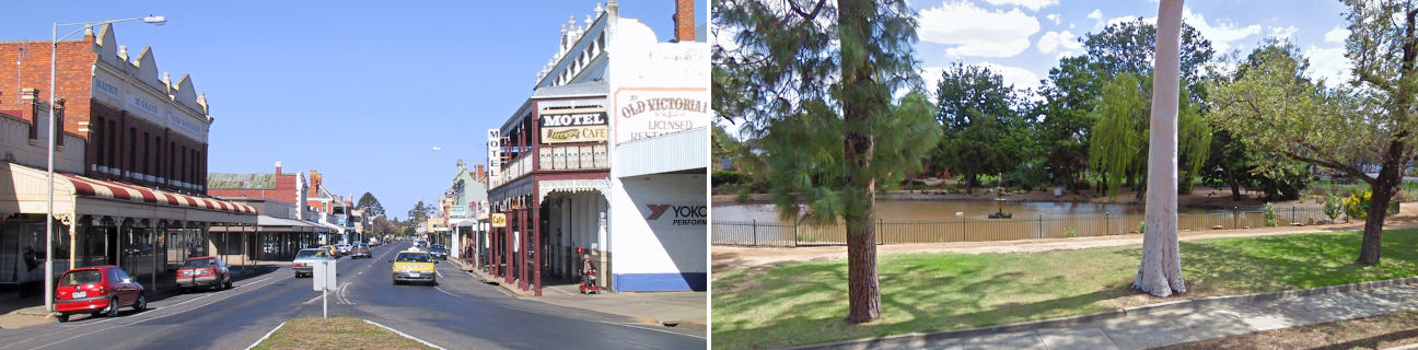
St Arnaud
Stay
See and do
Food and drink
Shopping
Getting around
Visitor information
Train
Maryborough station
(76 km away)
| Line | Operator | Timetable and stops | Map |
|---|---|---|---|
| Maryborough |  |
Maryborough - Melbourne Via Maryborough, Talbot, Clunes, Creswick, Ballarat |
Stawell station
(76 km away)
| Line | Operator | Timetable and stops | Map |
|---|---|---|---|
| The Overland |  |
Melbourne to Adelaide Via Southern Cross, North Shore, Ararat, Stawell, Horsham, Dimboola, Nhill, Bordertown (SA), Murray Bridge (SA), Adelaide (SA) |
Ararat station
(93 km away)
| Line | Operator | Timetable and stops | Map |
|---|---|---|---|
| Ararat | |
Ararat - Melbourne Via Ararat, Beaufort, Wendouree, Ballarat, Ballan, Bacchus Marsh, Melton, Cobblebank, Rockbank, Caroline Springs, Deer Park, Ardeer, Sunshine, Footscray, Southern Cross |
|
| The Overland | |
Melbourne to Adelaide Via Southern Cross, North Shore, Ararat, Stawell, Horsham, Dimboola, Nhill, Bordertown (SA), Murray Bridge (SA), Adelaide (SA) |
Bendigo, Eaglehawk, Epsom, Kangaroo Flat stations
(99 km away)
| Line | Operator | Timetable and stops | Map |
|---|---|---|---|
| Bendigo | |
Bendigo - Melbourne Via Epsom or Eaglehawk, Bendigo, Kangaroo Flat, Castlemaine, Malmsbury, Kyneton, Woodend, Macedon, Gisborne, Riddells Creek, Clarkefield, Sunbury, Watergardens, Footscray, Southern Cross |
|
| Echuca | |
Echuca - Melbourne Via Echuca, Rochester, Elmore, Goornong, Huntly, Epsom, Bendigo, Kangaroo Flat, Castlemaine, Malmsbury, Kyneton, Woodend, Macedon, Gisborne, Riddells Creek, Clarkefield, Sunbury, Footscray, Southern Cross |
|
| Swan Hill | |
Swan Hill - Melbourne Via Swan Hill, Kerang, Pyramid, Dingee, Raywood, Eaglehawk, Bendigo, Kangaroo Flat, Castlemaine, Malmsbury, Kyneton, Woodend, Gisborne, Watergardens, Footscray, Southern Cross |
Bus
| Route | Operator | Timetable | Map |
|---|---|---|---|
| St Arnaud to Stawell Via Navarre, Landsborough, Crowlands, Ararat, Ararat station, Great Western |
BusBiz | ||
| St Arnaud to Stawell Via Marnoo, Callawadda, Stawell station |
BusBiz | ||
| Donald to Bendigo Via St Arnaud, Dunolly, Tarnagulla, Bendigo station |
|
||
| Mildura to Melbourne Via Red Cliffs, Ouyen, Birchip, Donald, St Arnaud, Avoca, Dunolly, Maryborough, Maryborough station, Talbot, Talbot station, Clunes, Clunes station, Creswick, Creswick station, Ballarat, Ballarat station, Southern Cross station |
|
||
| Adelaide (SA) to Bendigo Via Mount Barker (SA), Murray Bridge (SA), Tailem Bend (SA), Keith (SA), Bordertown (SA), Kaniva, Nhill, Dimboola, Horsham, Murtoa, Rupanyup, Marnoo, St Arnaud, Dunolly, Tarnagulla, Bendigo station |
|
Taxi
| Operator | Areas covered | Phone |
|---|---|---|
| St Arnaud Taxi Service | St Arnaud | 0419 764 978 |