Mallacoota
Mallacoota
Stay
See and do
Food and drink
Shopping
Getting around
Visitor information
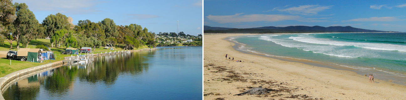
Mallacoota is a small holiday and fishing town situated at the mouth of Mallacoota Inlet in the far eastern corner of Victoria.
Mallacoota's remoteness has made it popular for visitors seeking a quiet seaside experience in an area surrounded by forests, secluded beaches and pristine waterways. Spectacular views can be enjoyed from many points along the coast, taking in the sandy beaches of the extensive inland waterway of the Mallacoota Inlet and the several islands located close to the shore. Fishing and boating are popular activities, and many visitors enjoy accommodation in beachfront apartments or foreshore caravan and camping grounds.
Mallacoota is surrounded by the 87,500 hectare Croajingolong National Park which extends for over 100 kilometres along the wilderness coast of the region. A number of lighthouses are present in the park, with the most prominent being the structure built in 1862 on the granite outcrop which makes up Gabo Island, located 13 kilometres from Mallacoota.
Just under 40 kilometres by road north of Mallacoota, via Genoa, the state border with New South Wales crosses the Princes Highway through an area of thick forest. The highway heads north along the New South Wales south coast.