Natimuk
Natimuk
Stay
See and do
Food and drink
Shopping
Getting around
Visitor information
The small town of Natimuk is located between Horsham and Edenhope in the Wimmera agricultural region of western Victoria.
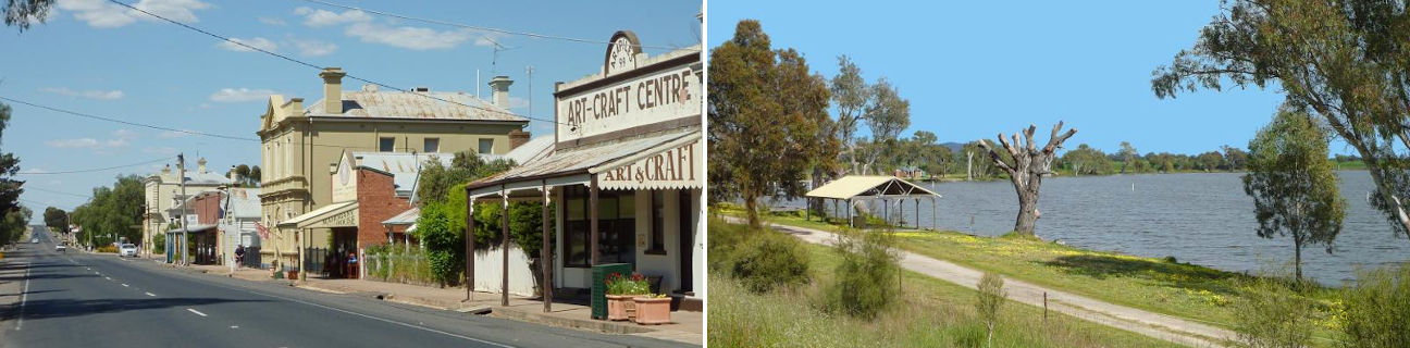
The town dates back to the 1870s when it supported the vast sheep stations in the area, but the growth of nearby Horsham eventually resulted in the town's decline. Several historic buildings which line Natimuk's main street are a legacy to its prosperous past, including the court house which was built in 1890.
Natimuk Creek meanders through the town along the northern side of the Wimmera Highway, and it is lined with parkland that includes walking tracks, a playground and picnic shelters.
Follow Lake Road and Natimuk Creek four kilometres north of the town centre to Lake Natimuk where there is a caravan park at the lake's southern end with a fishing jetty. Further northwards along the lake foreshore is a BBQ shelter, boat ramp and scenic spots where views across the lake and towards Mount Arapiles can be enjoyed.
Further north of Lake Natimuk are several access points to the Little Desert National Park with its arid landscape and wildflowers.
One of Natimuk's primary attractions is Mount Arapiles, which is located around 10 kilometres west of the town. It is one of Australia's best abseiling and rock climbing venues with a huge sandstone rock face. It is very popular with climbers, attracting enthusiasts from interstate and overseas. To access the peak, head west along the Wimmera Highway and turn onto the Mt Arapiles Summit Road. A side road leads to the Bluff Picnic Area where elevated panoramic views of the surrounding countryside can be enjoyed from a lookout at the car park. At the end of Mt Arapiles Summit Road is the Summit Picnic Area. A short but steep walking track leads from the car park up to the rocky mountain peak which is 369 metres above sea level. At the peak are communication towers and a lookout which provides impressive views over farm land and of lakes to the north. During the early springtime, yellow canola blooms create splashes of bright colour through the fields surrounding Mount Arapiles. Centenary Park is a camping and picnic area located at the eastern base of the mountain, accessed via Centenary Park Road, also known as Alfred Wright Lockwood Memorial Drive. Several walking trails lead up the mountain from this park.
Directly north of Mount Arapiles on the Natimuk-Frances Road is Mitre Rock. It is a sacred Aboriginal site consisting of a large rocky outcrop surrounded by a small reserve.