Rye
Rye
Stay
See and do
Food and drink
Shopping
Getting around
Visitor information
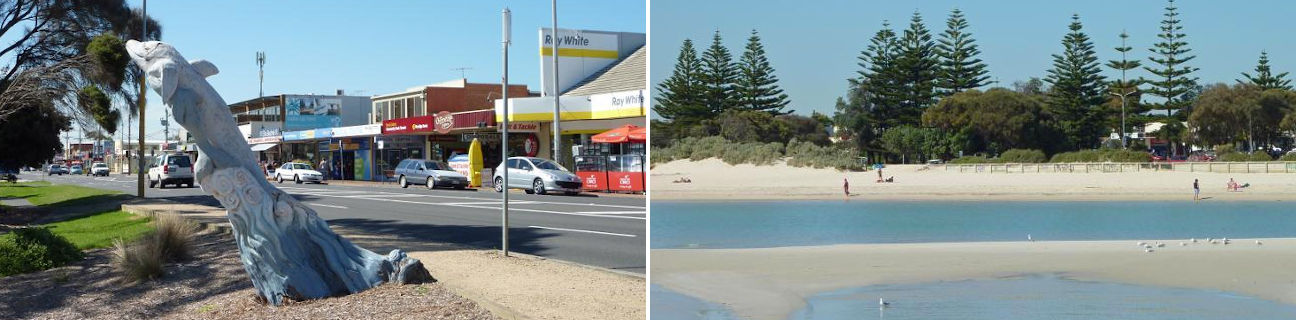
The coastal town of Rye is situated on the popular holiday destination of the Mornington Peninsula, nestled between Rosebud and Blairgowrie.
Point Nepean Road is Rye's main thoroughfare, running parallel to the town's bay beach. The main concentration of shops is located east of Dundas Street and includes a hotel, eateries, a major supermarket and other retailers.
Rye's main beach, fronting Port Phillip, offers safe sandy beaches, ideal for swimming and boating. There is a jetty, several boat ramps, and attractive foreshore facilities with picnic areas, shelters, playgrounds and walking tracks.
Around a kilometre west of the Rye Jetty is an outcrop of land called White Cliffs. At the base of the cliffs is a reconstructed old Lime Burners Kiln - a reminder of the mid-1800s when the extraction of lime was the area's primary industry. Scenic views along the coast can be enjoyed from lookout above the kiln.
Rye extends southwards across the narrow width of the Mornington Peninsula in this area, right down to the coastline fronting the open waters of Bass Strait. The Mornington Peninsula National Park spans the foreshore here, consisting of scenic walking tracks, rocky coastal features, dunes and pockets of sandy beach. A pathway and steps extends from Tasman Drive down to the sandy bay at Number 16 Beach.
Further south-east along the coast is Rye Ocean Beach, accessed from the southern end of Dundas Street. Officially located within in the small coastal community of St Andrews Beach, the beach and foreshore area also forms part of the Mornington Peninsula National Park, offering wide expanses of sandy beaches and rolling sand dunes covered in native vegetation. The next beach of significance further along the coast is St Andrews Beach which can be accessed via the car park at the end of Paradise Drive. Views can be enjoyed along the coast towards Cape Schanck and its lighthouse.