Wonthaggi
Wonthaggi
Stay
See and do
Food and drink
Shopping
Getting around
Visitor information
Wonthaggi is located in South Gippsland, several kilometres inland from the coast and between the seaside towns of Kilcunda and Inverloch.
Between 1909 and 1968, black coal was mined from Wonthaggi's network of underground mines, creating a thriving industrial settlement for miners and their families during those years. While mining operations have long ceased, the history of this period has been preserved at the State Coal Mine Historic Reserve. This reserve consists of several separate sites, with the main feature being the East Area Mine off Garden Street which consists of a visitor centre, equipment displays, restored historic buildings and a mine shaft which is open for underground tours. The Central Area Mine, accessed via West Area Road, was a major focus of coal mining operations and a number of walking tracks lead to the remains of buildings and mine shafts. The No. 20 Shaft, located on the Bass Highway north-west of Wonthaggi's town centre, has been preserved as a monument to the 17 men who lost their lives in two explosions while working inside this notorious mine.
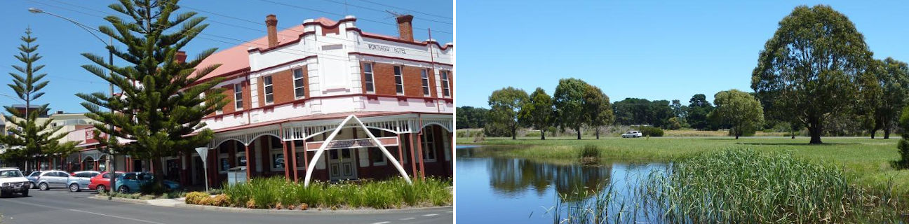
Wonthaggi has a thriving and attractive commercial centre, concentrated around Graham Street and extending into nearby Murray Street and McBride Avenue which is lined with Norfolk pines. At the corner of McBride Avenue and Murray Street is the Wonthaggi Hotel. Licensed in 1914, the hotel displays at its entrance the giant jawbones of a 23 metre whale that washed up on a local beach in 1923.
Several attractive reserves and parks can be found in Wonthaggi. Apex Park, located in Murray Street, displays a mine poppet head and is the site of Wonthaggi's former railway station which is now occupied by the Wonthaggi Historical Society and used as a museum. The section of McBride Avenue south of Watt Street opens up into a wide boulevard with vast expanses of lawn along its centre. These tree-lined lawns include a war memorial and provide elevated views down towards the town centre. Guide Park, located off the western end of Graham Street, has picnic areas, BBQs and an adventure playground. The Wonthaggi Wetlands Conservation Park is situated just north-west of the town's commercial centre and provides a network of walking tracks and boardwalks around lakes and through native vegetation. Access is available from either South Dudley Road or the western end of Korumburra Road.
A close and easily accessible part of the coast to Wonthaggi is the residential settlement of Harmers Haven, about 6 kilometres south of town off the end of Berrys Road. There are steps from the reserve at the top of the cliffs down to the sandy beach below where there are some rock formations. Just over a kilometre eastwards is Wreck Beach where a pathway from the car park leads to a lagoon wedged between sand dunes which overlook the ocean.
Around 8 kilometres south-east of the Wonthaggi town centre is the small seaside community of Cape Paterson. A hotel and a few shops can be found at the junction of Surf Beach Road and Market Place. Near the eastern end of Surf Beach Road is Cape Paterson's sheltered bay beach which consists of a sweeping stretches of sand, a rock pool for safe swimming and a boat ramp. Towards the western end of Surf Beach Road is the Cape Paterson Surf Life Saving Club and a surf beach which is bordered by coastal rock features.
Cape Paterson marks the start of the 12 kilometre scenic coastal drive to Inverloch which passes alongside the Yallock-Bulluk Marine & Coastal Park and offers spectacular coastal views.