Traralgon
Traralgon
Stay
See and do
Food and drink
Shopping
Getting around
Visitor information
Traralgon is located east of Morwell and is the largest city in the Latrobe Valley, which is home to most of Victoria's power generation facilities.
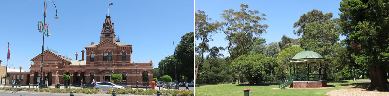
The city's large commercial centre includes the Traralgon Centre Plaza, South Side Central which incorporates the major regional railway station, and shops which line the attractive streets of Franklin Street, Seymour Street and Hotham Street. The landmark building in the town centre is the elegant and towering post office building, which dates back to 1887.
Wide tree-lined streets, attractive gardens, and a thriving commercial centre are characteristics of the Traralgon of today.
A short drive south of the town is the Loy Yang Power Complex and open-cut coal mine. The Hyland Highway passes right through the complex and a couple of visitor lookouts are provided to marvel at the massive scale of coal mining and electricity generation. The power station's two chimneys are 260 metres high - roughly the same height as Melbourne's Rialto Towers.
Further south of Traralgon the Strzelecki Ranges offer a number of scenic tourist drive routes, including the Grand Ridge Road and the route to the Tarra Bulga National Park. North of Traralgon are extensive alpine ranges which include such attractions as the ski resort of Mount Baw Baw, the Thomson Dam (which provides Melbourne with its largest supply of water), a number of state and national parks, and the historic town of Walhalla.