Mount Macedon
Mount Macedon
Stay
See and do
Food and drink
Shopping
Getting around
Visitor information
The small township of Mount Macedon lies part way up the mountain of the same name, located between the town of Macedon at the base and the actual mountain peak which soars to a height of just over 1,000 metres above sea level.
The Mount Macedon town centre includes a hotel, general store, a church and several plant nurseries.
Stanley Park, accessed via Waterfalls Road or Salisbury Road, contains a native grassland area, diverse vegetation, and several picnic areas. Turitable Creek, which runs through the park, cascades down a rocky ledge into a dense bush gully. While there's a lookout platform at the top of the waterfall, the best views are from the gully below.
In the Mount Macedon area are a number of historical grand Victorian homes with exquisite English gardens that most attractive in autumn when the leaves of the many deciduous trees transform into bright and blazing colours.
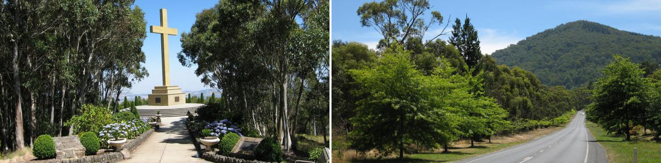
The Macedon Regional Park surrounds much of Mount Macedon and features a number of attractions. The most popular is the Memorial Cross Reserve, located at the end of Cameron Drive, which includes picnic and BBQ areas. A short walk along a sealed path from the tearooms takes visitors to the 21 metre tall Memorial Cross which was erected to honour those Australians who lost their lives in wars. Good views can be enjoyed from the cross and also from the Major Mitchell Lookout, which is located on a side-track before the cross.
The Camels Hump is the highest point in the Macedon Ranges, located near the start of Cameron Drive. Several walking tracks depart from the Camels Hump car park, with the most scenic being the steep 500 metre path that ascends to the peak. The viewing platform at the peak offers panoramic views to the north and west.
Sanatorium Lake is accessed via Lions Head Road which is almost opposite the entrance to Cameron Drive. The drive along this gravel road passes through the attractive Days Picnic Ground and then to the car park at Sanatorium Lake. A 250 metre walk from the car park along the Eco-Tourism Walking Trail takes visitors to an information shelter and the adjacent lake. Other picnic areas and walking trails are located near the lake.