Rosebud
Rosebud
Stay
See and do
Food and drink
Shopping
Getting around
Visitor information
Rosebud is a large beach-side centre fronting Port Phillip on the Mornington Peninsula, located between Rye and Dromana. The town was named after the English schooner that was blown ashore in 1855, a short distance to the west of where the Rosebud Pier now stands.
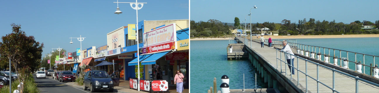
Rosebud's commercial centre stretches along one side of about a 2 kilometre length of Point Nepean Road, with some shops separated from this wide thoroughfare by a service road. The shopping precinct features attractive garden strips, paved areas and several wood carvings of notable local identities from the past. At the western end of the commercial strip is the large Rosebud Plaza Shopping Centre, while towards the eastern end is the smaller Rosebud Beach Shopping Centre, Rosebud Central Shopping Centre and local cinema complex.
Rosebud provides safe swimming beaches along its continuous stretch of sandy bay coastline, with the focal point being Rosebud Pier which it located opposite Jetty Road and extends about 300 metres into the water.
A notable feature of Rosebud's bay foreshore is a lack of commercial development. Most of the area between the coastal route of Point Nepean Road and the beach consists of community facilities, parkland and camping areas within sections of bushland.
A striking landmark in Rosebud is the bushy mountain peak of Arthurs Seat. It rises up in the distance behind the shops along Point Nepean Road and provides a scenic backdrop when viewed on Rosebud's beaches.
Rosebud provides plenty of sporting activities for visitors. As well as several golf courses within Rosebud itself, more can be found a short drive inland at Fingal and Boneo. Rosebud is also home to several large sports reserves including Olympic Park and Trueman Road Recreational Reserve.
A 12 kilometre journey south of Rosebud along Boneo Road is Cape Schanck where a historic lighthouse crowns the rugged southern tip of the Mornington Peninsula.