Map of Victoria
Location & maps
Transport
Airports
Trains
Trams
Buses
Car hire
Taxis & rideshare
Boats & ferries
Bicycles
Journey planner
Ticketing
Driving
Types of roads
Toll roads
Tunnels
Bridges
Traffic reports
Road rules
Driving in snow
Driving safety
Fuel
Electric car charging
Food quarantine rules
Weather
Facts & figures
Communications
Holidays
Visitor information
Your safety
Government
Melway online is an interactive map that displays maps directly from the Melway Street Directory. The map remembers what area you looked at last, but if you are using it for the first time, you will be presented with a map of Melbourne's CBD.
Click on the map of Victoria below.

Downloadable and printable road maps
- Overview road map showing distances between major centres (5 MB)
- Detailed road map (21 MB)
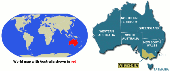
Location of Victoria
The state of Victoria is located in the south-eastern corner of mainland Australia and occupies approximately 3% of the area of land covered by Australia as a whole.
To the north is the state of New South Wales, while its western edge borders South Australia. In the south, Victoria is separated from the island state of Tasmania by the waters of Bass Strait.