South Gippsland coast
Driving routes
Adventure activities
Sport
Nature & wildlife
Art & culture
History & heritage
Food & drink
Entertainment
Shopping
Accommodation
Health & wellbeing
The South Gippsland coast drive provides the opportunity to discover some of the quieter and less commercialised areas of Victoria's coastline, beach holiday towns and several historic sea ports.
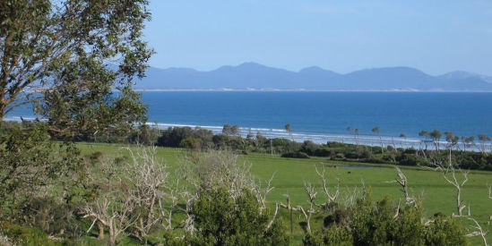
The journey commences south-east of Melbourne at Western Port, with its secluded settlements along the eastern side of the bay. Follow the Bass Strait coastline where you will discover holiday towns, unspoilt ocean beaches, rolling sand dunes and spectacular clifftop views. Head to the coastal wilderness of Wilsons Promontory, a national park and marine park which surrounds Victoria's most southerly point. The final part of the journey eastwards leads to historic fishing villages which lie at the base of the Strzelecki Ranges.
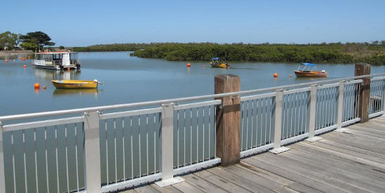
Tooradin
Located at the northern tip of Western Port, Tooradin provides an interesting stop on the South Gippsland coast journey. Take a stroll through parkland and along pathways beside Sawtells Inlet - a tidal channel which is popular with fishermen - or wander down to the boat ramp and beach where mangroves line much of the shoreline. For the more adventurous, there's an airfield in Tooradin offering skydiving and scenic flights.
Grantville
Soon after passing the turn-off for Lang Lang, the highway becomes known as the Bass Highway, with the South Gippsland Highway branching off eastwards towards Korumburra, which is the most direct route to Wilsons Promontory. The next town of significant size you'll come across is Grantville - a service centre for the surrounding district. There's a range of eateries along the highway, while less than 500 metres from the shops is Grantville's beach along the eastern side of Western Port where you will find a boat ramp, jetty and a coastal walk track. If you have time, the kids will love spending time at Maru Koala & Animal Park.
Corinella
Turn off the Bass Highway south of Grantville and head 7 kilometres along Corinella Road to the beachfront community of Corinella. Stop off at the Corinella General Store for refreshments then head down to Corinella's scenic foreshore area where you'll find a jetty and boat ramp. Good views of the bay can be enjoyed from Settlement Point.
Kilcunda
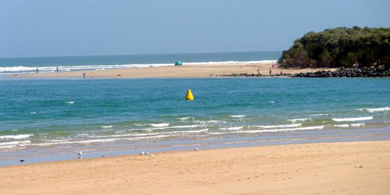
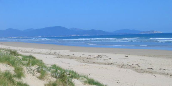
As you travel eastwards along the Bass Highway, you'll enjoy sweeping views of the coast as it meets the ocean waters of Bass Strait at Kilcunda. The Ocean View Hotel is an icon in Kilcunda, located beside the highway and providing scenic views of the coast from its elevated outdoor deck. The beaches around Kilcunda consist of unspoilt sweeping expanses of sand and dunes, combined with rocky headlands.
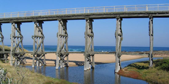
Just east of Kilcunda is the turn-off to the mouth of the Powlett River. Take a short detour along this road which leads to a sheltered inlet ideal for swimming and fishing.
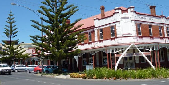
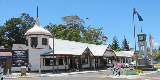
Wonthaggi
Wonthaggi is the largest town on the South Gippsland coast, located a few kilometres inland with an extensive commercial centre and attractive gardens. The town's former coal mining days can be relived at the State Coal Mine where relics of that era are on display and visitors can go on an underground mine tour.
Cape Paterson
Leaving the Bass Highway, travel 8 kilometres south of Wonthaggi along Bunurong Road to the small coastal community of Cape Paterson. There's some good surf beaches and an enclosed rock pool where safe swimming can be enjoyed.
Bunurong Coastal Drive
Follow Bunurong Road for 12 kilometres as it hugs the coastline between Cape Paterson and Inverloch. It's like a small scale version of the famed Great Ocean Road, providing many designated stopping areas along the way where you can explore a range of natural coastal attractions including Twin Reefs, Shack Bay, Eagles Nest and The Caves. There's rocky headlands and secluded bays with sandy beaches.
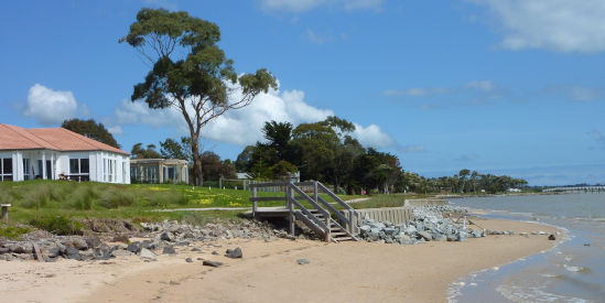
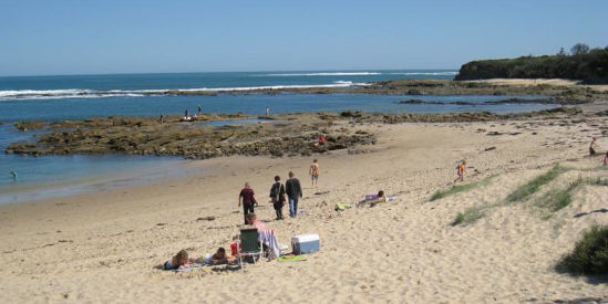
Inverloch
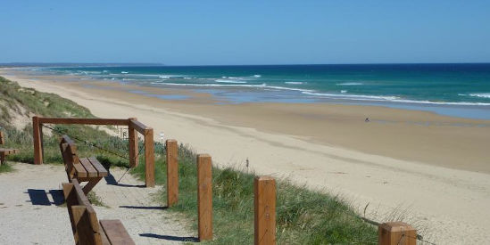
One of the South Gippsland coast's most popular coastal resort towns is Inverloch. Located at the entrance to Anderson Inlet, there's great surf beaches, plus safe boating and swimming within the inlet's calm waters. Attractive foreshore areas and a holiday atmosphere all make Inverloch a good choice to spend some time at.
Tarwin Lower
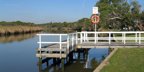
Head along Venus Bay Road eastwards from Inverloch until you reach the small town of Tarwin Lower. Situated on the banks of the wide Tarwin River, the town has a hotel which overlooks at the river and a regional icon in the form of the 35-metre Long Table beside the river. There's fishing and viewing platforms at various spots along the river.
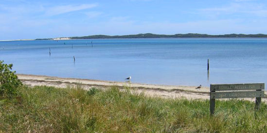
Venus Bay
If you take a 5 kilometre detour westwards from Tarwin Lower, you will arrive at the holiday community of Venus Bay. It fronts both the ocean at Bass Strait and the calm waters of Anderson Inlet. There's 5 designated ocean beaches to enjoy (numbered from 1 to 5), plus a bush reserve at Point Smythe which is situated directly across the water from Inverloch.
Walkerville
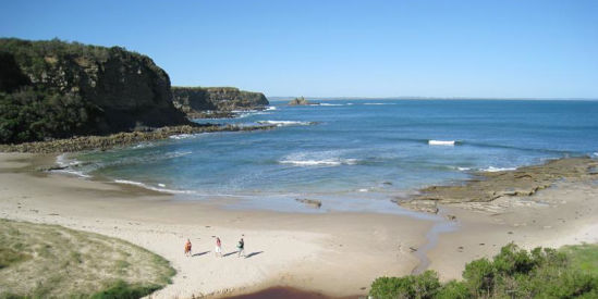
Head back to Tarwin Lower and take Walkerville Road which traverses gently rolling countryside to the small coastal town of Walkerville. Explore the limestone cliffs which overlook the unspoilt beaches and provide views across Waratah Bay, or head down to Cape Liptrap where a lighthouse presides over Bass Strait.
Waratah Bay
Follow the road towards Fish Creek and along the Cape Liptrap Coastal Park, then take Waratah Road to Waratah Bay. You'll arrive at a very quiet and secluded coastal community where the nearby mountains at Wilsons Promontory provide a scenic backdrop to the unspoilt sandy beaches of Waratah Bay.
Sandy Point
Situated on the coast, 11 kilometres by road east of Waratah Bay, is Sandy Point. It's a holiday retreat town, offering pristine ocean beaches and located next to Shallow Inlet which is bordered by sand dunes and a popular destination for windsurfers.
Yanakie
On the other side of Shallow Inlet from Sandy Point is the small town of Yanakie. Situated on an isthmus, it connects the mainland with Wilsons Promontory and is the last town on Promontory Road before you reach the entrance gate to the Wilsons Promontory National Park. There's a general store at Yanakie and beaches to explore at Corner Inlet and Shallow Inlet.
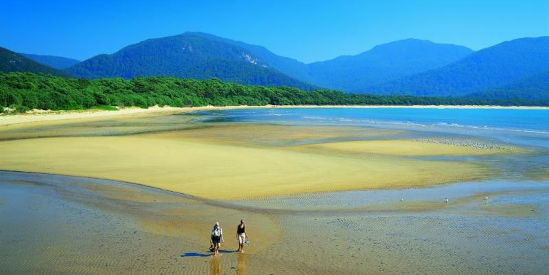
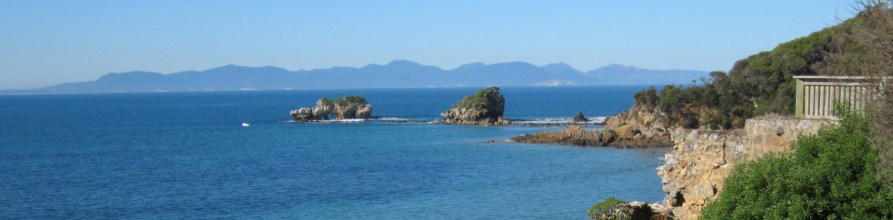
Wilsons Promontory
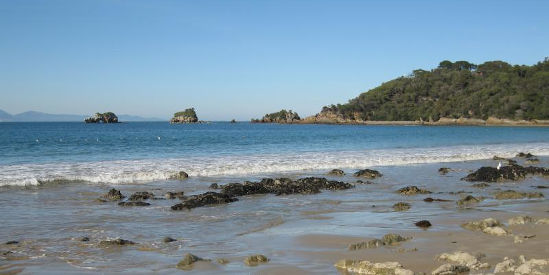
Wilsons Promontory is the southern most tip of the Australian mainland and is one of Victoria's most famous national parks. This coastal wilderness features untouched beaches, granite cliffs, forests, lakes and rivers which are all teeming with wildlife. With many walking tracks and natural attractions to explore, some visitors spend days or even weeks here.
Further information about Wilsons Promontory National Park.
Foster
Head northwards from Wilsons Promontory to the town of Foster, nestled in lush, rolling countryside, a few kilometres inland from Corner Inlet. There's great views to be had from the Foster North Lookout which overlooks Corner Inlet and Wilsons Promontory, while in the actual town centre, admire the talents of local artists at the Stockyard Gallery.
Toora
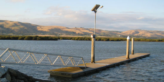
Rejoin the South Gippsland Highway at Foster then head eastwards to the small dairying town of Toora. Situated at the base of the scenic Strzelecki Ranges, there is a wind power farm located in the surrounding hills and a visitor area. For a panoramic view over Toora and the surrounding countryside, head to the lookout at Silcocks Hill. About 10 kilometres further along Silcocks Hill Road, via Hazel Park Road, are the scenic Agnes Falls. Toora is just a couple of kilometres inland from Corner Inlet where there is a boat ramp. This area is also recognised RAMSAR wetland site where you can view many migratory birds that make this area their home.
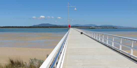
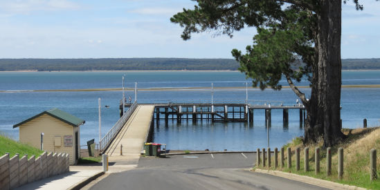
Port Welshpool
The next stop as you head east on the South Gippsland Highway is the small service town of Welshpool. Take a 5 kilometre detour south along Port Welshpool Road to the historic fishing village of Port Welshpool. Stroll along the attractive foreshore where there's a fishing wharf and a one kilometre long jetty aptly named Long Jetty. Returning to the South Gippsland Highway at Welshpool, turn into Slades Hill Road (opposite the primary school) and head north where scenic views can be enjoyed as the road climbs into the foothills of the Strzelecki Ranges. If you didn't visit the Agnes Falls and the surrounding scenic reserve when in Toora, you can also access them by continuing further along Slades Hill Road and then turning into Hazel Park Road.
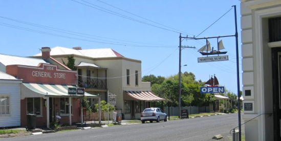
Port Albert
Return back to the South Gippsland Highway and when approaching Alberton, take the turn-off to Port Albert. You'll conclude the South Gippsland coast drive at one of Victoria's oldest sea ports which was established in 1841. There's several historic buildings in town and a maritime museum where you can examine memorabilia of the past. Head down to the wharf for fishing or boating, or drop into the kiosk there which sells both fresh and cooked fish. Be charmed by this scenic fishing village and spend a night there with some great accommodation available.